
Regional District of East Kootenay topographic map
Interactive map
Click on the map to display elevation.
About this map
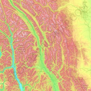
Name: Regional District of East Kootenay topographic map, elevation, terrain.
Average elevation: 1,628 m
Minimum elevation: 526 m
Maximum elevation: 3,357 m
Other topographic maps
Click on a map to view its topography, its elevation and its terrain.
Lone Butte
Canada > British Columbia > Cariboo Regional District > Area L (Lone Butte/Interlakes)
The northward advance of the Pacific Great Eastern Railway (PGE) rail head passed through Lone Butte in late April 1919. This construction camp had a large kitchen employing 25 cooks, of whom two received the Distinguished Conduct Medal and three the Military Medal during World War I. At an elevation of about…
Average elevation: 1,159 m