
Sunshine Coast topographic map
Interactive map
Click on the map to display elevation.
About this map
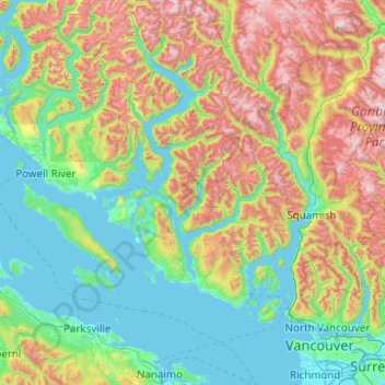
Name: Sunshine Coast topographic map, elevation, terrain.
Location: Sunshine Coast, British Columbia, Canada (49.12508 -124.40445 50.40508 -123.12445)
Average elevation: 649 m
Minimum elevation: -2 m
Maximum elevation: 2,758 m
Other topographic maps
Click on a map to view its topography, its elevation and its terrain.
Area F (Scotch Creek/Seymour Arm)
Canada > British Columbia > Columbia-Shuswap Regional District
Average elevation: 1,265 m