
Ataíde topographic map
Interactive map
Click on the map to display elevation.
About this map
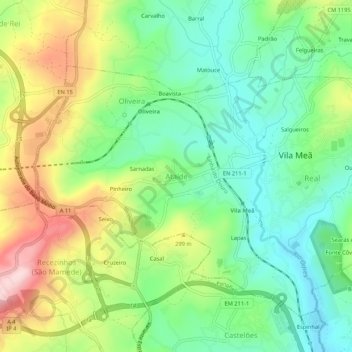
Name: Ataíde topographic map, elevation, terrain.
Location: Ataíde, Vila Meã, Amarante, Porto, 4605-378, Portugal (41.22913 -8.21480 41.26913 -8.17480)
Average elevation: 235 m
Minimum elevation: 132 m
Maximum elevation: 408 m
Other topographic maps
Click on a map to view its topography, its elevation and its terrain.