
Murombedzi topographic map
Interactive map
Click on the map to display elevation.
About this map
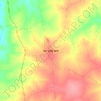
Name: Murombedzi topographic map, elevation, terrain.
Location: Murombedzi, Zvimba, Mashonaland West Province, Zimbabwe (-17.74525 30.15991 -17.66525 30.23991)
Average elevation: 1,301 m
Minimum elevation: 1,246 m
Maximum elevation: 1,341 m
Other topographic maps
Click on a map to view its topography, its elevation and its terrain.