
Bexar County topographic map
Interactive map
Click on the map to display elevation.
About this map
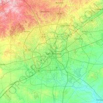
Name: Bexar County topographic map, elevation, terrain.
Location: Bexar County, Texas, United States (29.11428 -98.80649 29.76073 -98.11695)
Average elevation: 250 m
Minimum elevation: 111 m
Maximum elevation: 601 m
Other topographic maps
Click on a map to view its topography, its elevation and its terrain.