
Thank you for supporting this site ❤️
Make a donation
Make a donation
Harper topographic map
Click on the map to display elevation.
Thank you for supporting this site ❤️
Make a donation
Make a donation
About this map
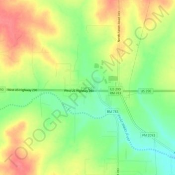
Name: Harper topographic map, elevation, terrain.
Location: Harper, Gillespie County, Texas, 78631, United States (30.28073 -99.27084 30.32073 -99.23084)
Average elevation: 634 m
Minimum elevation: 599 m
Maximum elevation: 668 m
Thank you for supporting this site ❤️
Make a donation
Make a donation