
Lochristi topographic map
Interactive map
Click on the map to display elevation.
About this map
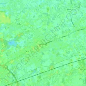
Name: Lochristi topographic map, elevation, terrain.
Location: Lochristi, Oost-Vlaanderen, Vlaanderen, 9080, België (51.07427 3.78661 51.12152 3.87893)
Average elevation: 6 m
Minimum elevation: 0 m
Maximum elevation: 11 m
Other topographic maps
Click on a map to view its topography, its elevation and its terrain.
Watergang
België > Vlaanderen > Lochristi
Watergang, Lochristi, Oost-Vlaanderen, Vlaanderen, 9080, België
Average elevation: 6 m