
Cascade Charter Township topographic map
Interactive map
Click on the map to display elevation.
About this map
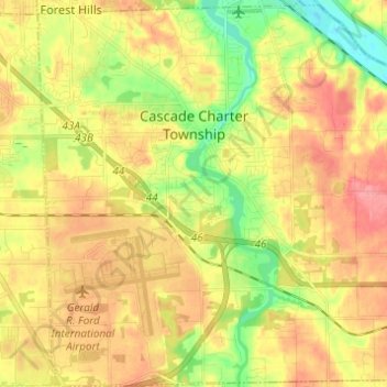
Name: Cascade Charter Township topographic map, elevation, terrain.
Average elevation: 229 m
Minimum elevation: 185 m
Maximum elevation: 267 m
Other topographic maps
Click on a map to view its topography, its elevation and its terrain.
Grand Rapids
États-Unis d'Amérique > Michigan > Kent County
Grand Rapids, Kent County, Michigan, États-Unis d'Amérique
Average elevation: 216 m
Algoma Township
États-Unis d'Amérique > Michigan > Kent County
Algoma Township, Kent County, Michigan, États-Unis d'Amérique
Average elevation: 242 m