
Gekbrong topographic map
Interactive map
Click on the map to display elevation.
About this map
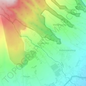
Name: Gekbrong topographic map, elevation, terrain.
Location: Gekbrong, Cianjur, West Java, Java, Indonesia (-6.87187 106.99640 -6.83187 107.03640)
Average elevation: 1,095 m
Minimum elevation: 839 m
Maximum elevation: 1,555 m
Other topographic maps
Click on a map to view its topography, its elevation and its terrain.
Salagedang
Indonesia > West Java > Cianjur
Salagedang, Cianjur, West Java, Java, Indonesia
Average elevation: 913 m