
Cimenteng topographic map
Interactive map
Click on the map to display elevation.
About this map
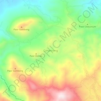
Name: Cimenteng topographic map, elevation, terrain.
Location: Cimenteng, Cianjur, West Java, Java, Indonesia (-7.00512 107.04138 -6.96512 107.08138)
Average elevation: 857 m
Minimum elevation: 601 m
Maximum elevation: 1,190 m
Other topographic maps
Click on a map to view its topography, its elevation and its terrain.
Salagedang
Indonesia > West Java > Cianjur
Salagedang, Cianjur, West Java, Java, Indonesia
Average elevation: 913 m