
Dolgellau topographic map
Interactive map
Click on the map to display elevation.
About this map
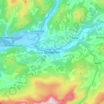
Name: Dolgellau topographic map, elevation, terrain.
Location: Dolgellau, Gwynedd, Wales, LL40 1PS, United Kingdom (52.70269 -3.92557 52.78269 -3.84557)
Average elevation: 226 m
Minimum elevation: -1 m
Maximum elevation: 859 m
Other topographic maps
Click on a map to view its topography, its elevation and its terrain.
Pentrefelin
United Kingdom > Wales > Gwynedd > Criccieth
Pentrefelin, Dolbenmaen, Criccieth, Gwynedd, Wales, LL52 0PE, United Kingdom
Average elevation: 72 m
Portmeirion
United Kingdom > Wales > Gwynedd > Portmeirion
Portmeirion, Gwynedd, Wales, LL48 6ER, United Kingdom
Average elevation: 9 m