
Madiun topographic map
Interactive map
Click on the map to display elevation.
About this map
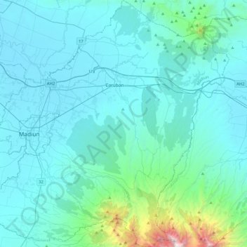
Name: Madiun topographic map, elevation, terrain.
Location: Madiun, Jawa Timur, Indonesia (-7.81409 111.44986 -7.40954 111.84750)
Average elevation: 278 m
Minimum elevation: 43 m
Maximum elevation: 2,525 m
Other topographic maps
Click on a map to view its topography, its elevation and its terrain.