
Vimieiro topographic map
Interactive map
Click on the map to display elevation.
About this map
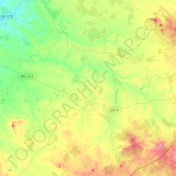
Name: Vimieiro topographic map, elevation, terrain.
Location: Vimieiro, Arraiolos, Évora, Portugal (38.77359 -7.97993 38.92842 -7.67363)
Average elevation: 231 m
Minimum elevation: 90 m
Maximum elevation: 478 m
Other topographic maps
Click on a map to view its topography, its elevation and its terrain.