
Duchesne County topographic map
Interactive map
Click on the map to display elevation.
About this map
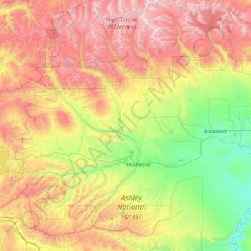
Name: Duchesne County topographic map, elevation, terrain.
Location: Duchesne County, Utah, USA (39.80361 -110.90499 40.83482 -109.97289)
Average elevation: 2,406 m
Minimum elevation: 1,409 m
Maximum elevation: 4,096 m
Other topographic maps
Click on a map to view its topography, its elevation and its terrain.
Timpanogos Glacier
USA > Utah > Aspen Grove
Timpanogos Glacier, Mount Timpanogos Trail #052, Aspen Grove, Utah County, Utah, USA
Average elevation: 3,148 m