
Mayberry topographic map
Interactive map
Click on the map to display elevation.
About this map
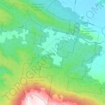
Name: Mayberry topographic map, elevation, terrain.
Location: Mayberry, Meander Valley, Tasmanie, 7304, Australie (-41.61349 146.23257 -41.52922 146.33471)
Average elevation: 539 m
Minimum elevation: 204 m
Maximum elevation: 1,412 m
Other topographic maps
Click on a map to view its topography, its elevation and its terrain.
Breadalbane
Australie > Tasmanie > Breadalbane
Breadalbane, Tasmanie, 7212, Australie
Average elevation: 176 m
Mole Creek Karst National Park
Australie > Tasmanie > Devonport
Mole Creek Karst National Park, Western Bluff Track, Mayberry, Devonport, Tasmanie, 7310, Australie
Average elevation: 626 m