
Ter topographic map
Interactive map
Click on the map to display elevation.
About this map
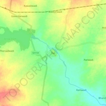
Name: Ter topographic map, elevation, terrain.
Location: Ter, Dharashiv, Maharashtra, 413508, India (18.27984 76.10115 18.35984 76.18115)
Average elevation: 651 m
Minimum elevation: 627 m
Maximum elevation: 681 m
Other topographic maps
Click on a map to view its topography, its elevation and its terrain.
Gairan Wasti
India > Maharashtra > Dharashiv > Waruda
Gairan Wasti, Waruda, Dharashiv, Maharashtra, India
Average elevation: 663 m
Yedshi
India > Maharashtra > Dharashiv
Yedshi, Dharashiv, Maharashtra, 413405, India
Average elevation: 684 m