
Chiredzi topographic map
Click on the map to display elevation.
About this map
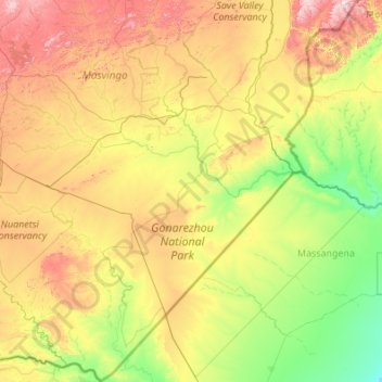
Name: Chiredzi topographic map, elevation, terrain.
Location: Chiredzi, Masvingo Province, Zimbabwe (-22.42411 30.94323 -20.39822 32.40560)
Average elevation: 400 m
Minimum elevation: 96 m
Maximum elevation: 1,229 m
Other topographic maps
Click on a map to view its topography, its elevation and its terrain.