
Tasmania topographic map
Interactive map
Click on the map to display elevation.
About this map
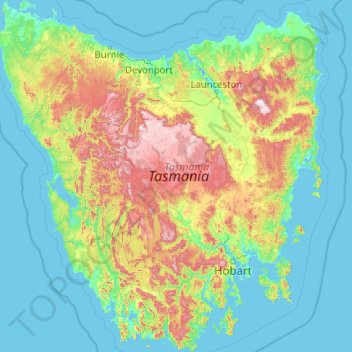
Name: Tasmania topographic map, elevation, terrain.
Location: Tasmania, Australia (-43.64304 144.60734 -40.64139 148.35910)
Average elevation: 220 m
Minimum elevation: -3 m
Maximum elevation: 1,524 m
Other topographic maps
Click on a map to view its topography, its elevation and its terrain.