
arrondissement de Fès-Médina topographic map
Interactive map
Click on the map to display elevation.
About this map
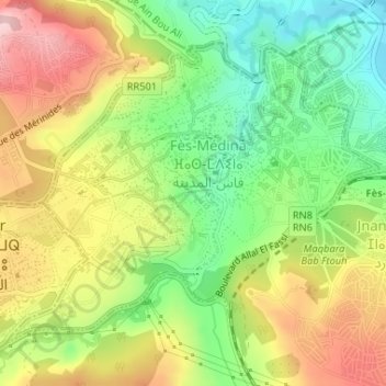
Name: arrondissement de Fès-Médina topographic map, elevation, terrain.
Average elevation: 344 m
Minimum elevation: 240 m
Maximum elevation: 466 m
Other topographic maps
Click on a map to view its topography, its elevation and its terrain.
Fès
Maroc > Pachalik du Fes > Fès
Fès, Pachalik du Fes, Préfecture de Fès, Fès-Meknès, Maroc
Average elevation: 432 m