
Gwanda topographic map
Interactive map
Click on the map to display elevation.
About this map
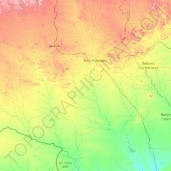
Name: Gwanda topographic map, elevation, terrain.
Location: Gwanda, Matabeleland South, Zimbabwe (-22.00368 28.62694 -20.55259 29.89455)
Average elevation: 827 m
Minimum elevation: 498 m
Maximum elevation: 1,570 m
Other topographic maps
Click on a map to view its topography, its elevation and its terrain.
Upper Ncema Dam
Upper Ncema Dam, Umzingwane, Matabeleland South, Zimbabwe
Average elevation: 1,154 m
Mzingwane
Mzingwane, Gwanda, Matabeleland South, Zimbabwe
Average elevation: 821 m
Limpopo River
Limpopo River, Beitbridge, Matabeleland South, Zimbabwe
Average elevation: 715 m
Matobo National Park
Matobo National Park, Matobo, Matabeleland South, Zimbabwe
Average elevation: 1,331 m