
Mendut topographic map
Interactive map
Click on the map to display elevation.
About this map
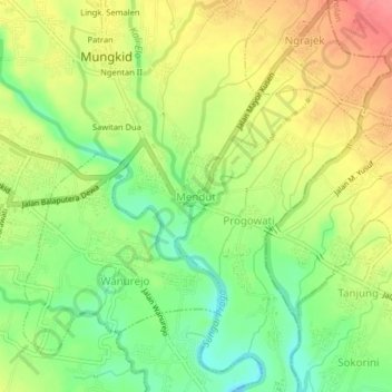
Name: Mendut topographic map, elevation, terrain.
Location: Mendut, Magelang, Central Java, Java, 56553, Indonesia (-7.62611 110.20912 -7.58611 110.24912)
Average elevation: 241 m
Minimum elevation: 204 m
Maximum elevation: 279 m
Other topographic maps
Click on a map to view its topography, its elevation and its terrain.
Jerukagung
Indonesia > Central Java > Magelang > Jerukagung
Jerukagung, Magelang, Central Java, 56483, Indonesia
Average elevation: 461 m