
Parc Geisendorf topographic map
Interactive map
Click on the map to display elevation.
About this map
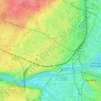
Name: Parc Geisendorf topographic map, elevation, terrain.
Location: Parc Geisendorf, Grottes et Saint-Gervais, Genève, 1211, Suisse (46.20860 6.12871 46.21079 6.13282)
Average elevation: 407 m
Minimum elevation: 367 m
Maximum elevation: 457 m
Other topographic maps
Click on a map to view its topography, its elevation and its terrain.