
منطقة اللاذقية topographic map
Interactive map
Click on the map to display elevation.
About this map
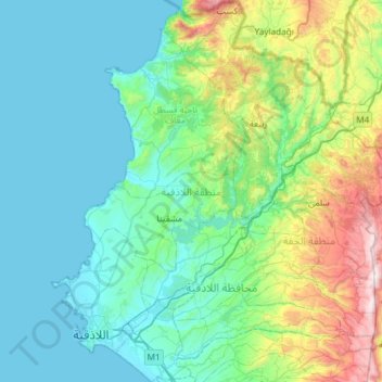
Name: منطقة اللاذقية topographic map, elevation, terrain.
Location: منطقة اللاذقية, Gouvernorat de Lattaquié, Syrie (35.45921 35.71657 35.94081 36.15335)
Average elevation: 284 m
Minimum elevation: 0 m
Maximum elevation: 1,536 m
Other topographic maps
Click on a map to view its topography, its elevation and its terrain.