
Reet topographic map
Interactive map
Click on the map to display elevation.
About this map
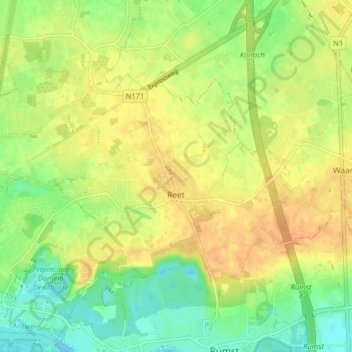
Name: Reet topographic map, elevation, terrain.
Location: Reet, Rumst, Antwerpen, 2840, België (51.08986 4.35886 51.11908 4.43920)
Average elevation: 18 m
Minimum elevation: -2 m
Maximum elevation: 32 m
Hoewel Reet een landelijk karakter heeft behouden ligt het dicht tegen de Antwerpse agglomeratie. Het gebied is zandig en de hoogte bedraagt 12-31 meter.
Other topographic maps
Click on a map to view its topography, its elevation and its terrain.