
Aknīste topographic map
Interactive map
Click on the map to display elevation.
About this map
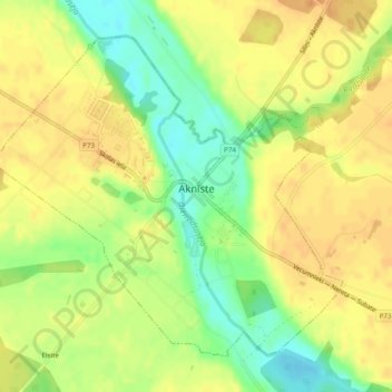
Name: Aknīste topographic map, elevation, terrain.
Location: Aknīste, Jēkabpils novads, LV-5208, Latvia (56.14993 25.72274 56.17200 25.76648)
Average elevation: 107 m
Minimum elevation: 86 m
Maximum elevation: 119 m
Other topographic maps
Click on a map to view its topography, its elevation and its terrain.