
Buller District topographic map
Interactive map
Click on the map to display elevation.
About this map
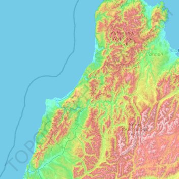
Name: Buller District topographic map, elevation, terrain.
Location: Buller District, West Coast, New Zealand (-42.52404 171.32557 -40.77471 172.69210)
Average elevation: 437 m
Minimum elevation: 0 m
Maximum elevation: 2,227 m
Other topographic maps
Click on a map to view its topography, its elevation and its terrain.
Westland District
Westland District, West Coast, New Zealand
Average elevation: 437 m
Mokihinui
New Zealand > West Coast > Buller District
Mokihinui, Buller District, West Coast, New Zealand
Average elevation: 55 m
Charleston
New Zealand > West Coast > Buller District
Charleston, Buller District, West Coast, New Zealand
Average elevation: 24 m
Granity
New Zealand > West Coast > Buller District
Granity, Buller District, West Coast, New Zealand
Average elevation: 150 m
Okuru
New Zealand > West Coast > Westland District
Okuru, Westland District, West Coast, New Zealand
Average elevation: 3 m
Gillespies Beach
New Zealand > West Coast > Westland District
Gillespies Beach, Westland District, West Coast, New Zealand
Average elevation: 14 m
Greymouth
New Zealand > West Coast > Grey District
Greymouth, Grey District, West Coast, 7801, New Zealand
Average elevation: 40 m
Hokitika
New Zealand > West Coast > Westland District
Hokitika, Westland District, West Coast, 7810, New Zealand
Average elevation: 14 m
Atarau
New Zealand > West Coast > Grey District
Atarau, Grey District, West Coast, 7843, New Zealand
Average elevation: 59 m
Lewis Pass
New Zealand > West Coast > Buller District
Lewis Pass, Buller District, West Coast, New Zealand
Average elevation: 1,039 m
Waikowai Stream
New Zealand > West Coast > Westland District
Waikowai Stream, Westland District, West Coast, New Zealand
Average elevation: 13 m
Taylorville
New Zealand > West Coast > Grey District
Taylorville, Grey District, West Coast, New Zealand
Average elevation: 125 m
Mount Aspiring National Park
Mount Aspiring National Park, West Coast, New Zealand
Average elevation: 770 m
Cape Foulwind
New Zealand > West Coast > Buller District > Cape Foulwind
Cape Foulwind, Buller District, West Coast, New Zealand
Average elevation: 14 m
Hooker Glacier
New Zealand > West Coast > Westland District
Hooker Glacier, Westland District, West Coast, New Zealand
Average elevation: 1,930 m
Lake Brunner
New Zealand > West Coast > Grey District > Moana
Lake Brunner, Moana, Grey District, West Coast, New Zealand
Average elevation: 168 m
Belmont
New Zealand > West Coast > Westland District
Belmont, Westland District, West Coast, New Zealand
Average elevation: 1,623 m
Hukarere
New Zealand > West Coast > Buller District
Hukarere, Buller District, West Coast, New Zealand
Average elevation: 131 m
Ikamatua
New Zealand > West Coast > Buller District
Ikamatua, Buller District, West Coast, New Zealand
Average elevation: 122 m
Ngahere
New Zealand > West Coast > Grey District > Ngahere
Ngahere, Grey District, West Coast, 7804, New Zealand
Average elevation: 49 m
Westport
New Zealand > West Coast > Buller District
Westport, Buller District, West Coast, 7825, New Zealand
Average elevation: 13 m
Haast
New Zealand > West Coast > Westland District
Haast, Westland District, West Coast, New Zealand
Average elevation: 15 m
Fox Glacier
New Zealand > West Coast > Westland District
Fox Glacier, Westland District, West Coast, New Zealand
Average elevation: 1,848 m
Franz Josef
New Zealand > West Coast > Westland District
Franz Josef, Westland District, West Coast, 7856, New Zealand
Average elevation: 277 m
Reefton
New Zealand > West Coast > Buller District
Reefton, Buller District, West Coast, 7830, New Zealand
Average elevation: 310 m
Ahaura River
New Zealand > West Coast > Grey District
Ahaura River, Grey District, West Coast, 7843, New Zealand
Average elevation: 386 m
Mount Tasman
New Zealand > West Coast > Westland District
Mount Tasman, Westland District, West Coast, New Zealand
Average elevation: 2,798 m