
Pondok Aren topographic map
Interactive map
Click on the map to display elevation.
About this map
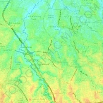
Name: Pondok Aren topographic map, elevation, terrain.
Location: Pondok Aren, South Tangerang, Banten, Indonesia (-6.29423 106.67499 -6.23957 106.71885)
Average elevation: 29 m
Minimum elevation: 14 m
Maximum elevation: 44 m
Other topographic maps
Click on a map to view its topography, its elevation and its terrain.