
Thank you for supporting this site ❤️
Make a donation
Make a donation
Highlands topographic map
Click on the map to display elevation.
Thank you for supporting this site ❤️
Make a donation
Make a donation
About this map
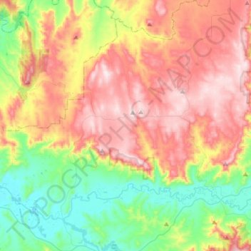
Name: Highlands topographic map, elevation, terrain.
Location: Highlands, Shire of Murrindindi, Victoria, Australia (-37.16400 145.35426 -37.00446 145.48274)
Average elevation: 431 m
Minimum elevation: 153 m
Maximum elevation: 683 m
Thank you for supporting this site ❤️
Make a donation
Make a donation
Other topographic maps
Click on a map to view its topography, its elevation and its terrain.