
Central Coast topographic map
Interactive map
Click on the map to display elevation.
About this map
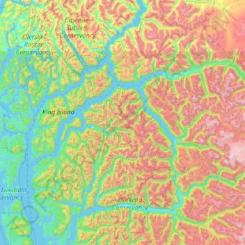
Name: Central Coast topographic map, elevation, terrain.
Location: Central Coast, British Columbia, Canada (51.48296 -127.76188 52.76296 -126.48188)
Average elevation: 789 m
Minimum elevation: -1 m
Maximum elevation: 2,967 m
Other topographic maps
Click on a map to view its topography, its elevation and its terrain.
Area F (Scotch Creek/Seymour Arm)
Canada > British Columbia > Columbia-Shuswap Regional District
Average elevation: 1,265 m