
Le Bourg topographic map
Interactive map
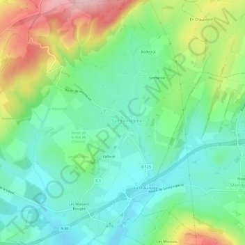
Click on the map to display elevation.
About this map
Name: Le Bourg topographic map, elevation, terrain.
Average elevation: 356 m
Minimum elevation: 284 m
Maximum elevation: 504 m
Other topographic maps
Click on a map to view its topography, its elevation and its terrain.
La Bouresse
France > Bourgogne-Franche-Comté > Saône-et-Loire > Sainte-Hélène > Sermesse
La Bouresse, Sermesse, Sainte-Hélène, Chalon-sur-Saône, Saône-et-Loire, Bourgogne-Franche-Comté, France métropolitaine, 71390, France
Average elevation: 344 m
Sainte-Hélène
France > Bourgogne-Franche-Comté > Saône-et-Loire > Sainte-Hélène
Sainte-Hélène, Chalon-sur-Saône, Saône-et-Loire, Bourgogne-Franche-Comté, France métropolitaine, 71390, France
Average elevation: 360 m