
Le Bas Pâtis topographic map
Interactive map
Click on the map to display elevation.
About this map
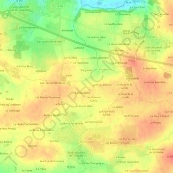
Name: Le Bas Pâtis topographic map, elevation, terrain.
Average elevation: 76 m
Minimum elevation: 39 m
Maximum elevation: 99 m
Other topographic maps
Click on a map to view its topography, its elevation and its terrain.
Le Pont Hamon
France > Bretagne > Ille-et-Vilaine > Domagné
Le Pont Hamon, Domagné, Fougères-Vitré, Ille-et-Vilaine, Bretagne, France métropolitaine, 35113, France
Average elevation: 78 m