
Stranraer topographic map
Interactive map
Click on the map to display elevation.
About this map
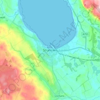
Name: Stranraer topographic map, elevation, terrain.
Average elevation: 45 m
Minimum elevation: -1 m
Maximum elevation: 187 m
Other topographic maps
Click on a map to view its topography, its elevation and its terrain.
Lochmaben
Reino Unido > Escocia > Dumfries and Galloway
Lochmaben, Dumfries and Galloway, Escocia, DG11 1NQ, Reino Unido
Average elevation: 75 m