
Hoevenen topographic map
Interactive map
Click on the map to display elevation.
About this map
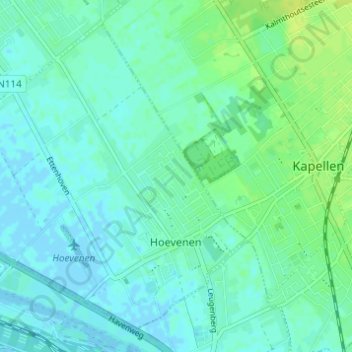
Name: Hoevenen topographic map, elevation, terrain.
Location: Hoevenen, Stabroek, Antwerpen, Vlaanderen, België (51.29709 4.35596 51.33051 4.41715)
Average elevation: 5 m
Minimum elevation: -3 m
Maximum elevation: 13 m