
Charlottenburg topographic map
Interactive map
Click on the map to display elevation.
About this map
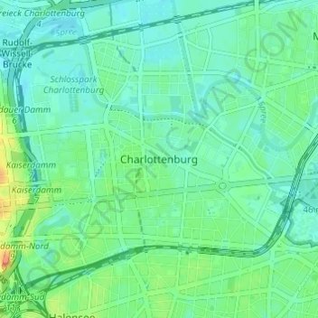
Name: Charlottenburg topographic map, elevation, terrain.
Location: Charlottenburg, Charlottenburg-Wilmersdorf, Berlijn, Duitsland (52.49902 13.28062 52.53237 13.34143)
Average elevation: 41 m
Minimum elevation: 31 m
Maximum elevation: 67 m
Other topographic maps
Click on a map to view its topography, its elevation and its terrain.