
La Bâte topographic map
Interactive map
Click on the map to display elevation.
About this map
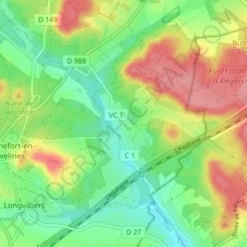
Name: La Bâte topographic map, elevation, terrain.
Average elevation: 115 m
Minimum elevation: 77 m
Maximum elevation: 165 m
Other topographic maps
Click on a map to view its topography, its elevation and its terrain.
Reculet
France > Île-de-France > Yvelines > Longvilliers
Reculet, Longvilliers, Rambouillet, Yvelines, Île-de-France, France métropolitaine, 78730, France
Average elevation: 134 m