
Le Mas topographic map
Interactive map
Click on the map to display elevation.
About this map
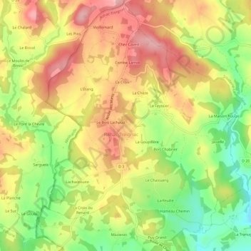
Name: Le Mas topographic map, elevation, terrain.
Average elevation: 424 m
Minimum elevation: 344 m
Maximum elevation: 492 m
Other topographic maps
Click on a map to view its topography, its elevation and its terrain.
Hameau Chemin
France > Nouvelle-Aquitaine > Corrèze > Rilhac-Treignac
Hameau Chemin, Rilhac-Treignac, Tulle, Corrèze, Nouvelle-Aquitaine, France métropolitaine, 19260, France
Average elevation: 397 m