
Houghton topographic map
Interactive map
Click on the map to display elevation.
About this map
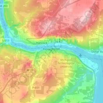
Name: Houghton topographic map, elevation, terrain.
Location: Houghton, Houghton County, Michigan, États-Unis d'Amérique (47.09791 -88.63770 47.14119 -88.51084)
Average elevation: 269 m
Minimum elevation: 177 m
Maximum elevation: 373 m