
Fontefría topographic map
Interactive map
Click on the map to display elevation.
About this map
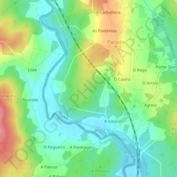
Name: Fontefría topographic map, elevation, terrain.
Location: Fontefría, O Castro, Parada, Ordes, Corunha, Galiza, Espanha (43.05086 -8.46395 43.07086 -8.44395)
Average elevation: 273 m
Minimum elevation: 233 m
Maximum elevation: 347 m