
Afleidingskanaal van de Leie topographic map
Interactive map
Click on the map to display elevation.
About this map
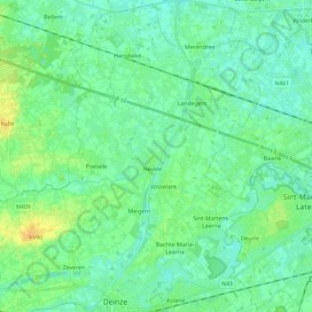
Name: Afleidingskanaal van de Leie topographic map, elevation, terrain.
Average elevation: 9 m
Minimum elevation: 2 m
Maximum elevation: 23 m
Other topographic maps
Click on a map to view its topography, its elevation and its terrain.
Deinze
België > Vlaanderen > Deinze
Deinze, Gent, Oost-Vlaanderen, Vlaanderen, België
Average elevation: 10 m