
Ait Khouy آيت خويــي topographic map
Interactive map
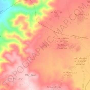
Click on the map to display elevation.
About this map
Name: Ait Khouy آيت خويــي topographic map, elevation, terrain.
Average elevation: 483 m
Minimum elevation: 266 m
Maximum elevation: 579 m
Other topographic maps
Click on a map to view its topography, its elevation and its terrain.
Tanalt
Tanalt, caïdat de Tanalt, cercle d'Aït Baha, Province de Chtouka Aït Baha, Souss-Massa, 87552, Maroc
Average elevation: 1,027 m