
Daïra Djimla topographic map
Interactive map
Click on the map to display elevation.
About this map
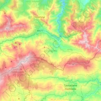
Name: Daïra Djimla topographic map, elevation, terrain.
Location: Daïra Djimla, Jijel, Algérie (36.53940 5.67766 36.63023 5.96266)
Average elevation: 751 m
Minimum elevation: 95 m
Maximum elevation: 1,601 m
Other topographic maps
Click on a map to view its topography, its elevation and its terrain.
Djimla
Algérie > Jijel > Daïra Djimla > Djimla
Djimla, Daïra Djimla, Jijel, Algérie
Average elevation: 803 m