
Bir el-Djir topographic map
Interactive map
Click on the map to display elevation.
About this map
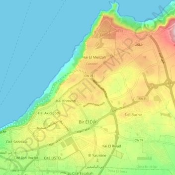
Name: Bir el-Djir topographic map, elevation, terrain.
Location: Bir el-Djir, Daïra Bir El Djir, Oran, Algérie (35.69479 -0.59812 35.77647 -0.50975)
Average elevation: 109 m
Minimum elevation: 0 m
Maximum elevation: 318 m
Other topographic maps
Click on a map to view its topography, its elevation and its terrain.
Hassi Bounif
Algérie > Oran > Daïra Bir El Djir > Hassi Bounif
Hassi Bounif, Daïra Bir El Djir, Oran, 31028, Algérie
Average elevation: 122 m