
Gaital topographic map
Interactive map
Click on the map to display elevation.
About this map
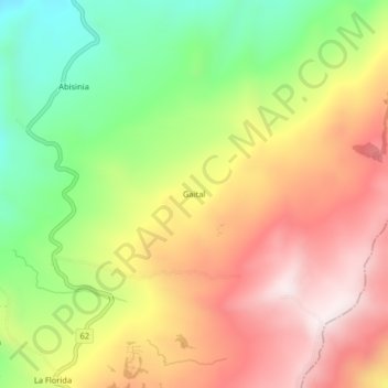
Name: Gaital topographic map, elevation, terrain.
Location: Gaital, Vélez, Santander, RAP Gran Santander, Colombia (6.05762 -73.71710 6.09762 -73.67710)
Average elevation: 2,442 m
Minimum elevation: 2,099 m
Maximum elevation: 2,771 m