
Arêches topographic map
Interactive map
Click on the map to display elevation.
About this map
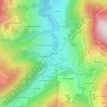
Name: Arêches topographic map, elevation, terrain.
Average elevation: 1,239 m
Minimum elevation: 943 m
Maximum elevation: 1,718 m
Other topographic maps
Click on a map to view its topography, its elevation and its terrain.
Les Gèrats
France > Auvergne-Rhône-Alpes > Savoie > Arêches
Les Gèrats, Arêches, Beaufort, Albertville, Savoie, Auvergne-Rhône-Alpes, France métropolitaine, 73270, France
Average elevation: 1,496 m