
Krikilan topographic map
Interactive map
Click on the map to display elevation.
About this map
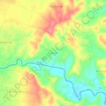
Name: Krikilan topographic map, elevation, terrain.
Location: Krikilan, Sragen, Central Java, Java, Indonesia (-7.47375 110.81746 -7.43375 110.85746)
Average elevation: 132 m
Minimum elevation: 88 m
Maximum elevation: 177 m
Other topographic maps
Click on a map to view its topography, its elevation and its terrain.
Jabung
Indonesia > Central Java > Sragen
Jabung, Sragen, Central Java, Indonesia
Average elevation: 88 m