
Saas topographic map
Interactive map
Click on the map to display elevation.
About this map
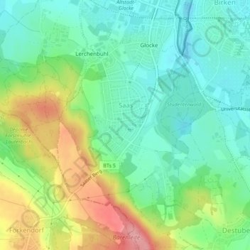
Name: Saas topographic map, elevation, terrain.
Location: Saas, Lerchenbühl, Glocke, Saas, Bayreuth, Beieren, Duitsland (49.90873 11.55080 49.92947 11.57736)
Average elevation: 381 m
Minimum elevation: 342 m
Maximum elevation: 454 m
Other topographic maps
Click on a map to view its topography, its elevation and its terrain.