
Hickory Ridge topographic map
Interactive map
Click on the map to display elevation.
About this map
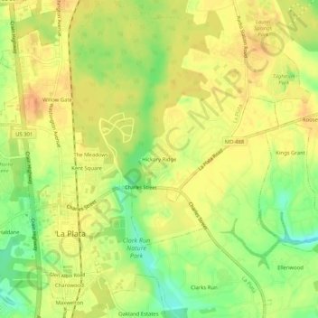
Name: Hickory Ridge topographic map, elevation, terrain.
Average elevation: 53 m
Minimum elevation: 28 m
Maximum elevation: 69 m
Other topographic maps
Click on a map to view its topography, its elevation and its terrain.
Clarks Run
United States > Maryland > Charles County > La Plata
Clarks Run, La Plata, Charles County, Maryland, 20646, United States
Average elevation: 49 m