
Ksar El Boukhari topographic map
Interactive map
Click on the map to display elevation.
About this map
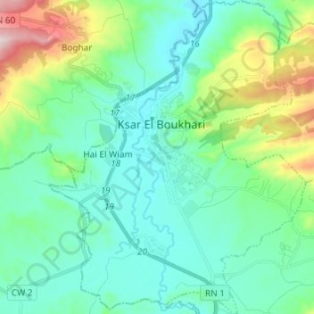
Name: Ksar El Boukhari topographic map, elevation, terrain.
Location: Ksar El Boukhari, Daïra Ksar El Boukhari, Médéa, 26300, Algérie (35.82662 2.70654 35.92527 2.80636)
Average elevation: 711 m
Minimum elevation: 582 m
Maximum elevation: 1,168 m
La commune est située à 623 mètres d'altitude, au-dessus de l'oued Chelif.