
Guanajuato topographic map
Interactive map
Click on the map to display elevation.
About this map
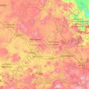
Name: Guanajuato topographic map, elevation, terrain.
Location: Guanajuato, Mexico (19.91275 -102.09703 21.83942 -99.67130)
Average elevation: 2,005 m
Minimum elevation: 873 m
Maximum elevation: 3,508 m
Other topographic maps
Click on a map to view its topography, its elevation and its terrain.