
Weelde topographic map
Interactive map
Click on the map to display elevation.
About this map
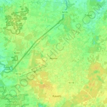
Name: Weelde topographic map, elevation, terrain.
Location: Weelde, Ravels, Turnhout, Antwerpen, Vlaanderen, 2381, België (51.38286 4.92786 51.44035 5.08821)
Average elevation: 28 m
Minimum elevation: 18 m
Maximum elevation: 36 m
Other topographic maps
Click on a map to view its topography, its elevation and its terrain.
Weelde Statie
België > Antwerpen > Turnhout > Ravels > Weelde > Weelde Statie
Weelde Statie, Weelde, Ravels, Turnhout, Antwerpen, Vlaanderen, 2387, België
Average elevation: 27 m